Alex Lorch /// Geospatial Data Analyst and Designer
Home
Work
About
Resume
Alex Lorch /// Geospatial Data Analyst and Designer
Home
Work
About
Resume
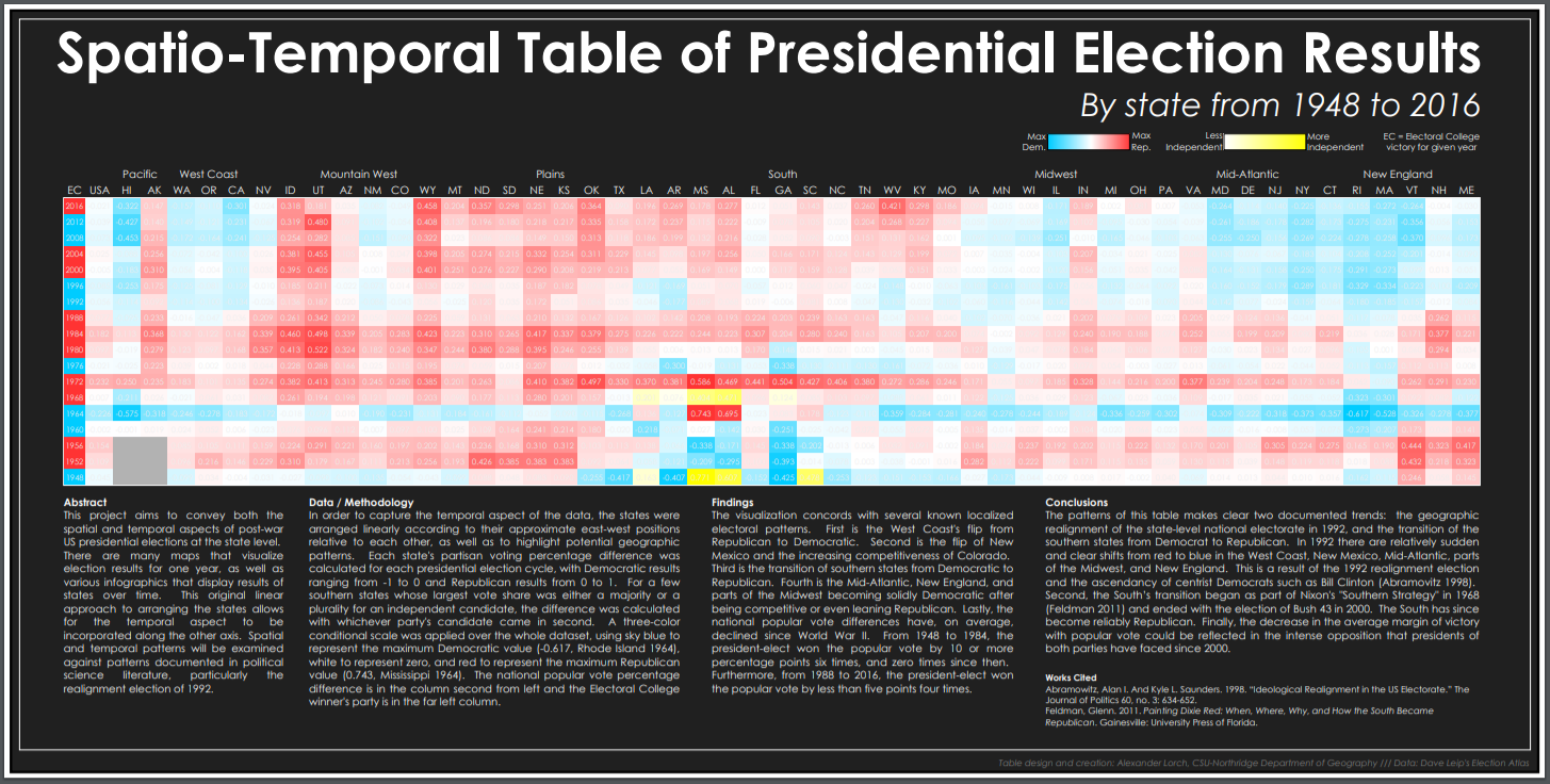
Spatio-Temporal Table of Presidential Election Results 1948 to 2016
All
US Temperature Ranges Map
Spatio-Temporal Table of Presidential Election Results 1948 to 2016
Crime in Boulder, Colorado
Linear Regression Model of 2016 Presidential Election Results
Wildfires in Monterey County, California
US Temperature Ranges Map
Spatio-Temporal Table of Presidential Election Results 1948 to 2016
Crime in Boulder, Colorado
Linear Regression Model of 2016 Presidential Election Results
Wildfires in Monterey County, California